The tale of our epic adventure follows. If you have a short attention span, you can just look at the pictures. If you keep reading, though, you'll be rewarded with breathtaking beauty and daring rescues.
The Peace Wagon peaces out
 Vintage Peace Wagon: John and me, and the Peace Wagon in March 2007 after our Provo Peak climb
We had to stop in Spanish Fork to pick up a bit more gear, and then we were off to Zion. As we were leaving Spanish Fork, John pointed out a funny noise that the Peace Wagon made when you turned the wheels really sharply and asked if I knew what it was. I thought it might be the CV joint, but he said he thought it was the transmission.
About an hour later, we were merrily rolling down I-15, talking about life, when the Peace Wagon lurched and made a clunking sound. John turned to me and said, "It's not supposed to do that, is it?" I didn't really need to respond, though, because it made another clunking sound, and then continued to make lots of bad noises. We passed a "Fillmore, 1 mile" sign right then, and we hoped that we'd be able to make it at least to the exit. The car was still going, but the sounds were getting worse.
We did make it to the exit, and we needed to quickly figure out where to go. I suggested that we turn right, since it was downhill and closer, so right we went. As we went that way, though, we realized that there wasn't much there, and that left was probably the better choice. After all, there were two gas stations to the left, and only one to the right. :) Unfortunately, the Peace Wagon was starting to give up the ghost, and it was having a hard time making it up the overpass. I got out and started pushing while John rocked it from drive to neutral. A nice guy in a truck behind us jumped out and helped push for a minute.
After a nice little workout (for me, although John offered to push) we made it to a parking spot at the Maverick gas station. It was clear that the sound John had asked me about in Spanish Fork was indeed the transmission. The Peace Wagon was in critical condition, and wouldn't be taking us to southern Utah.

Plan B(enj)
After a moment of silence for the trusty (up 'til then, anyway), somewhat dusty vehicle that had taken so many people on so many adventures, John started making calls and talking to people at the gas station to figure out what to do about the car. Meanwhile, I started making calls to figure out how to avoid canceling our Zion trip. I really wanted to get out of Provo and have a bit of time away from the stresses of life, so I was determined to not let a little thing like a destroyed transmission ruin our trip.
I called a lot of people. It turns out that 9:30 p.m. on the day after Thanksgiving on 5 minutes' notice isn't the ideal time for people to come to Zion. My brother could come pick us up, but he couldn't go to the park. Several other friends were still out of town for Thanksgiving. One friend could come, but didn't want to drive alone out to Fillmore. As I was running out of people to call, I decided to call my friend Benj.
Benj and I met each other this summer in California, and he lives in Salt Lake these days. We've tried to plan some hiking trips together this fall, but our schedules haven't lined up yet. I didn't call him right at first because he lives in Salt Lake, which is an extra hour or so away, and we were already short on time. With all of the Provo options exhausted, though, I decided to call him as a last resort.
Benj answered the phone. The conversation went something like this:
"Hi Benj; it's Bruce. This is probably a pretty long shot, but I was wondering if you wanted to go to Zion National Park."
"When?"
"Um... in about five minutes."
I explained the situation in a little more detail, and he told me to talk him into it. I must have said something right, because he said he was just crazy enough to come. It was his only open weekend for quite a while, and he had been thinking not too long before about what he was going to do with his free time. We could provide an answer to that question. :) It also turned out that he was in Orem for a family get-together, so he was an hour closer than I expected.
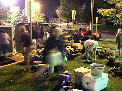
When I got off the phone, I called my brother and had him pack up some gear for Benj (thanks Dave!). John and I relaxed for a while at the Maverick and waited for our ride to show up.
The Peace Wagon's disobedience had slowed us down, but hadn't stopped us. We were still going to Zion. We made it to our camp site around 2 a.m., threw our sleeping bags out, and went right to sleep.
On the (wrong?) trail

After a nice 5-hour nap, we awoke to some crisp desert air. It had gotten a lot colder, and I think we all woke up before the alarm went off at 7:20. We quickly packed up, and we were at the visitor center by 7:50 to pick up our permit. After a bit o' paperwork, we were off to the trailhead.
We got there around 9 a.m. and started heading up what turned out to be the wrong drainage. After realizing our mistake, we backtracked to the car and headed out the right way. Our little detour cost us half an hour.
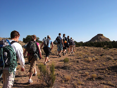
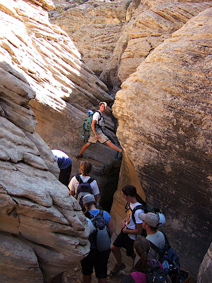
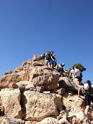
The approach to the canyon took us up the Pine Creek drainage, up a gully, over a saddle, and then down into the canyon. There was some nice slickrock hiking along the way.
 John nearing the saddle at the top of the Spry Canyon drainage
 View from the saddle. East Temple on the left, Twin Brothers on the right, West Temple mesa off in the distance. Spry Canyon is right in the middle.
Into the canyon
 Benj at the top of the first rappel
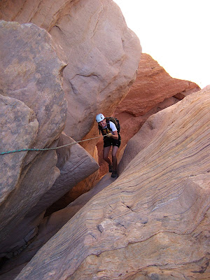
A bit less than an hour and a half from the trailhead, we dropped into the canyon. We reached the first rappel, which is the longest, but also one of the most tame. It's a pretty low-angle slickrock slab that you just kind of walk down. Too steep to downclimb, but not steep enough to really make you feel like you're getting your money's worth out of the rappel.

We continued down the canyon, interleaving rappels with walks through quicksand in the bottom of the watercourse. There had been some rain a week or so before, and a lot of the sand was really saturated with water. It looked solid, but as soon as you stepped on it, it would turned to mush and suck you in. Kept us on our toes. There were a few places in narrower slots where stepping on the quicksand would actually cause it to start flowing down the slot.
 Benj at the top of a rappel
 Benj skillfully evading the water
 John is more hydrophilic than Benj
Down, down, down
There are about ten rappels in Spry Canyon, so we stayed busy with the ropes. Despite the recent rain, we managed to avoid getting soaked for most of the canyon. There were a few places where we had to wade up to our calves, and one thigh-deep wade, but our tops stayed dry for most of the canyon.
 Benj on a fun free rappel under a little waterfall
Some of the rappels were especially cool. One was into a deep, dark, narrow slot, and we couldn't see the bottom. We tossed some rocks from the top to see if there was water below (there was). We also timed the fall to measure how far down it was (2.5 seconds; to find the distance, just use Newton's old 1/2at2, for a distance of about 30 meters). Since I was leading the group, I went first on all of the rappels, which sometimes meant I didn't know if I was rappelling into a pool or not. Makes life a little more exciting, you know? It turns out that I was able to swing over and land on dry ground on the deep, dark rappel.
Unfortunately, when things start getting exciting (and wet), the cameras stay inside the drybag, so I don't have a lot of good pictures from the coolest rappels.
 John rappelling off a big tree that he built a nice anchor on
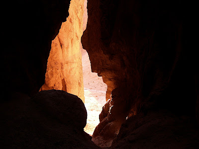
 This sliver of light was the only sun that we touched all day. We saw the sun a lot, sometimes just ten feet away on the other side of the canyon, but this was the only time we reached it.
 John belaying Benj. It turns out that you could swing over to a little sand island and then walk through pretty shallow water to avoid the pothole.
Narrow escape
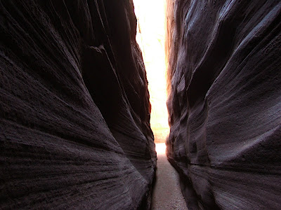
The last little bit of the canyon becomes a little more intense. The slot turns to the south and narrows up. The narrow slot is really pretty, but it also makes it harder to avoid the water, since there's often no way to go around it. (As the canyon became more intense, I was focused on things other than taking pictures, so there are only words from here on out.)
As we entered this section, we heard another group behind us. We remarked to each other that it was nice to know that someone else was back there, so that if one of our ropes got stuck or one of us got hurt, they would be able to help us out. That little bit of conversation turned out to be kind of ironic later.
The last section of the slot is the narrowest, and it was filled with water that looked pretty deep. Before we entered that section, we decided that we would hurry through as quickly as possible so that we could get back out into the sun and warm up.
I went first. There was a short slickrock slide, followed by a narrow pool that was 10 or 15 feet long. I eased into the pool, hoping that my feet would hit the bottom and I wouldn't really have to get wet, but it wasn't to be. The chilly water sucked all the air out of my lungs, and soon I was swimming as quick as I could to the other side of the pool. I emerged to stand on some quicksand, shivering.
John started down the rappel after me, and right before he was about to drop into the water, we heard the group behind us yell to us. It was really echoy in the canyon, and they were a little way back, so it was hard to hear. After a minute, though, we figured out that they were saying that their rope was stuck, and they wanted us to wait for them. If they had been 10 minutes later, we would have pulled our rope already, it would have been too late.
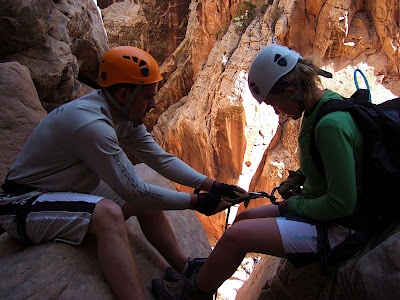
To set up a rappel, you normally loop your rope through a rappel ring that's anchored at the top to bolts drilled into the rock, or a sling wrapped around a tree. You rappel down both sides of the rope, and then pull on one side to retrieve your rope at the bottom. However, sometimes the rope can get stuck (in a crack, for example) when you try to pull it down. Having the last rappeller make sure that the rope is positioned just right and free from twists and tangles helps out a lot, but sometimes the rope gets stuck anyway.
Getting a rope stuck in a canyon can be really bad if you're not prepared with an extra. Without a rope, you have no way to rappel out of the canyon, and you could be trapped.
The group behind us was in a pretty tight situation. They decided to cut the ends off their ropes, and they used those to get down to us. However, their cut ropes weren't long enough to make it all the way out of the canyon, so they would have been stuck our help.
While we were waiting for the other group, I started to get pretty cold. I was in a shady slot, and I had just swum though a pool of cold water. I experienced the early stages of hypothermia the very first time I went canyoneering, and I could see that I could easily become hypothermic in my current situation. I was shivering quite a bit, and I was having a hard time warming up since there wasn't room for me to move around.
We decided that our group needed to get out of the slot into the open area below where we could warm up. Thankfully, our rope was long enough that we could make it down the next rappel without pulling it from the anchors way back above the previous rappel. That way, we could escape and still leave the rope for the group behind us to use.
About 45 minutes after I swam the pool, I, John, and Benj rappelled out of the slot into an open area below. We yelled to the other group that they could come down, and arranged for them to leave our rope at the ranger station. We wanted to get out before it got dark, since we still had a long hike down a boulder field without a trail. We still had a hike out, but it was a relief to know that we were out of the slot, and the danger of hypothermia had passed.
Unfortunately, we discovered that there was one more rappel, so we were stuck until they were done with our rope up above—or so we thought. We spent the time putting on warm, dry clothes and getting a bit to eat. The sun was setting, and we were getting worried about finding the route down. John remembered that we had a really long section of webbing, so we pulled it out to see if it would be long enough to reach the bottom of the last rappel. It was just a little too short, but we strung some slings together to make it a little longer, and it just reached the bottom. I was the only one who had rappelled down webbing before, so I went first to demonstrate that it worked just fine. John and Benj followed right after.
Out of the canyon, but not out of the woods
By the time we were to the bottom, it was pretty dark, and the other group was just about out of the slot above us. We decided at that point that it would be better to wait for them and stick together. The deciding factor was that they had a car, and could give us a ride back to our car, which we had left at the top of the slot. (We were originally planning to hitchhike.)
The other group retrieved our webbing, rigged our rope and rappelled down the last drop. As they came down, we finally got to see the faces that went with the voices we had been talking to. When they were all down, they pulled the rope, but it got stuck. Shoot! We tugged and yanked and repositioned and flicked, but nothing seemed to work. Both ends of the rope were still on the ground, so I decided to climb back up the rope using ascenders, free it up from whatever it was caught on, rappel back down, and hope that we could pull it after that. While I was setting up my ascenders, John kept bouncing and pulling on the rope. When I was just about ready to climb the rope, it came free. Yes!
Down the dark mountain
After eating a little food (one of the other group shared some delicious pumpkin chocolate chip cookies—yum!), we packed up our gear and headed down the boulder field. There are actually two routes down: one directly down the boulder field that follows the water course, and one down a more bare, sandy slope. The Park Service has closed off the trail down the slope due to erosion problems, and instead asks people to go down the watercourse, which requires navigating around boulders and rappelling down a cliff.
Considering our situation, however, we decided that following the closed trail would give us the best chances of making it down that night, and we really wanted to get down that night to avoid a search and rescue operation the next day. We were worried about getting cliffed out if we took the Park's preferred route. We didn't know exactly where the slope we wanted to follow was, and it was impossible to tell where we were in the dark, but we knew that it was generally to our right. One guy in the other group led out, and did a terrific job at routefinding. We had to crawl through boulders and brush (yucca and thorny bushes are not your friends in the dark!), but eventually we made it to the bare, open slope that we were looking for, although trying as much as possible to stick to durable surfaces. I found it amusing that the people in the other group were ecology students, and they were walking down the slope that had been closed to prevent erosion. They must have had quite the internal crises. I didn't feel very good about the situation, either, but considering the circumstances, I felt that it was a prudent choice.
Back to civilization
About 2 hours after the last rappel, we made it down to Pine Creek. It took us a minute to find the trail, but after that it was an easy walk on a well-used trail back to the car. We were all really glad to be back to civilization. We loaded up our gear into their car for them to give us a 3-mile ride back to our vehicle.
As we were pulling away, I noticed that their gas gauge was on empty, and I asked if the gauge was accurate. The girl driving didn't know, so she stopped to ask the others in her group. The consensus was that it really was empty, but that we could probably make it to our car and then they could make it out of the park to a gas station.
One of the other group had turned on her phone and checked her voicemail on the way down, and had discovered that one of their friend had alerted the Park Service that their group was missing. Had we not been there, there would have been a search and rescue operation on Sunday to find them. As it happened, a ranger drove by right as we reached the road, and so we stopped for a second to talk to him. He radioed in that the group had been found, and we asked him if he could give us a ride back to our car. He started to give us a lecture about how we should have thought about filling up our tank before, but one of the guys in the other group explained that that was their car, and that we had rescued them. The ranger agreed to give me a ride back to the car.
For the second time in two Zion trips, I was unexpectedly riding back up the mountain and through the tunnel to get the car we had left at the trailhead. Last time it was due to a key locked in a car; this time it was due to an unexpected rescue.
We drove to the visitor center, washed up a bit, and then began the long drive back home. We stopped in Cedar City for a much-needed dinner and some much-needed caffeine and then continued on our way. We stopped in Fillmore on the way back to clean out the Peace Wagon, and we decided to take a nap while we were there. Even with caffeine, it was pretty hard to stay awake after our short night's sleep the night before, followed by all of the day's events. I didn't make it back to Provo until about 3:30 a.m., and John and Benj still had drive to Salt Lake after that.
What started out on a whim as a quick, fun trip turned into quite the epic adventure. I'm glad that things turned out well. A lot of things fell into place so that we were in the right place at the right time to help rescue the group that was behind us. I'm glad that we were prepared and that we made good decisions in a stressful situation. It might sound like everything went really smoothly from my account, but there were a couple of hours where things were pretty stressful. The canyon acoustics made it hard to communicate, and there were a lot of unknowns. We had to balance our needs with our desires to help the other group. We didn't know what gear they had, or how much experience they had. There was also a lot of time pressure, since it was getting dark and cold as the situation progressed.
In the end, I think that things turned out well. Looking back, I don't see much that I would change if I could do it over again. Lending a hand cost us about three hours, but it was certainly worth it. They probably would have survived just fine without our help, but they would have had a pretty unpleasant freezing night and chilly morning alone in the canyon. It felt good to be able to help.
If you made it all the way down here and still want more, don't forget to look at the rest of the pictures.